

Boston Harbor Inlet

Introduction:
Boston is a vibrant city with a diverse boating scene. Boating areas are spread throughout the region, offering a range of options for boaters. From Winthrop, Snake Island, and Belle Isle in the north to Dorchester Bay and the Neponsett River in the south, there are numerous marinas to explore. It’s important to plan ahead and make reservations as availability can vary.
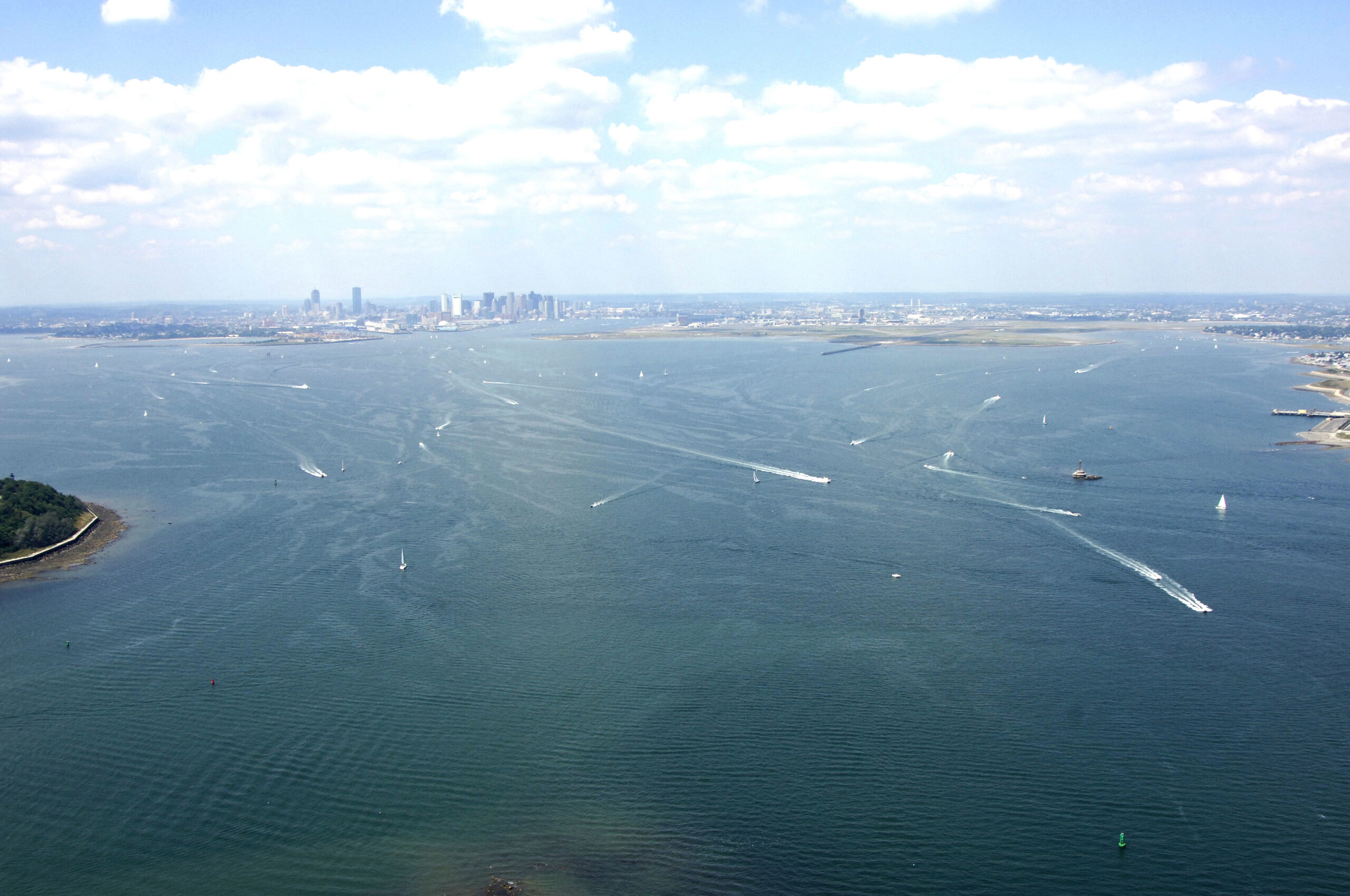
The image above provides a captivating view from the east, looking west over the entrance to Boston at President Roads, the main channel into the city. On the left-hand side, you can see the northern tip of Long Island, also known as Long Island Head, while the southern tip of Deer Island is visible on the right. Further in the distance is Boston’s Logan International Airport, and downtown Boston can be identified by the tall buildings on the horizon.
History:
Boston has a rich history, initially developing as a center for Puritan life and later becoming renowned as the birthplace of the American Revolution. The historic event known as the Boston Tea Party sparked tensions between the Colonies and Great Britain, ultimately leading to the fight for independence.
Navigating the Water:
To navigate the waters around Boston, refer to NOAA Chart 13270.
While there are multiple approaches to Boston from the Atlantic, we will focus on the primary entrance through the North Channel, starting northeast of Deer Island. When approaching from the Atlantic, locate the red and white Morse (A) buoy marked “NC” at waypoint N42 22.530 W70 54.297. From there, set a course of approximately 248 degrees magnetic for 0.8 miles to intercept the flashing green buoy “1A” and flashing red buoy “2.”
After successfully entering the North Channel, you can follow a line of red or green buoys into the President Roads area. We’ll focus on the green side of the channel. From flashing green buoy “1A,” head southwest to reach flashing green buoy “3.” Continue following the buoys to flashing green buoy “5” and then to flashing green buoy “9.”
At flashing green buoy “PR,” you will enter the President Roads Channel. Set a course of approximately 264 degrees magnetic for about 2.1 miles to reach flashing green buoy “1,” which will guide you into Boston Harbor proper, approximately one mile east-southeast of Fort Independence.
For detailed information on other areas around Boston, such as Dorchester Bay, Weymouth Fore River, Neponsett River, and Town River Bay, refer to our comprehensive coverage of Massachusetts Harbor inlets. Each section includes details on marina facilities, navigation suggestions, and important notices for mariners.
Local Notices to Mariners:
Local Notices to Mariners are available online from the U.S. Coast Guard.